Today we went to check out the Apache trail. I thought that I had a first over my big brother, but alas, after talking to him he had already done the complete Apache Trail with Mardi! Damn!!
We drove to Apache Junction where we picked up #88 Hwy which was our starting point. The Apache Trail was built in the early 1900's to provide an access road for the building of the Roosevelt Dam. Some of the early photographs are mind boggling of what they had to go through. The trail also provided a means for Stage Coaches and Mule Trains to supply the town of Globe.
The first thing we came across was the Ghost Town and mine of Goldfield. Gold was discovered around Superstitious Mountain and this area once had a population of 4000.

Most of the buildings were on the original foundations and were very rustic and original looking.


Superstition Mountain sits in the background.

As we were leaving the Ghost Town, this old dude came riding in.

This is a Saguaro National Forest and this is a typical scene along the way. Saguaro cactus take up to 75 years to grow arms and can grow up to 50 feet and live up to 150 years! They can hold up to a ton of water.


We started working our way along the scenic Apache Trail and came upon Canyon Lake. If you look in the lower left corner of the picture you can see a bass boat working the shoreline.

There were a few hundred boats moored at the marina on Canyon Lake. A very popular place.
We moved along until we came to the town of Tortilla Flat (population 6).
This area was set up as a base camp to supply the Rockefeller Dam project. They still don't have phone service of any type here.

This is the original schoolhouse that is now a museum.

The stores were lined with one dollar bills!! The operator figured there was about $10,000 in bills on the walls and ceilings of the buildings!


We each had a prickly pear ice cream cone before we left (very tasty).
We continued on a few more miles before the road turned to gravel. There were some awesome views. Again the pictures don't do it justice.

Lots of switchbacks and speed was 15 mph in most places. We finally got to Fish Creek Hill a drop with a 10% decline and lots of switchbacks and had to turn around because the next 4 mile section had closed the day before and wouldn't reopen until late January. 8O(

You can see the Fish Creek Hill in this shot, declining from right to left. Notice the retaining wall on the right side of the picture that was built in the 1900's. You can also see the trail switching back and forth in the distance.

It was obvious why the road was closed when you looked at some of the roadway that we had proceeded on.

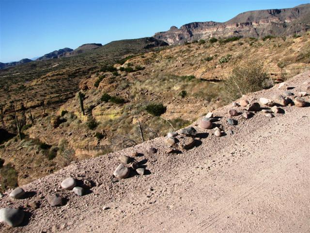
This is how close you were to the edge at times!
Notice the rock barricade hahahahaha!
We backtracked along the route that we had taken and ended up at a museum where this stagecoach was located. Pretty tight quarters for four people and I can only imagine the smooth ride it provided!

Well I guess we'll have to return to complete it another day. This was a nice way to get away from the city for a day. No serious vertigo although we both had popped a couple of pills along the way.
No comments:
Post a Comment